LA CLOCHE SILHOUETTE TRAIL – 7 DAYS, 6 NIGHTS – AUGUST 7, 2014
Killarney Provincial Park, Ontario, Canada
(Part 3 of 3 – Days 5, 6 and 7)
(Part 1 is HERE)
(Part 2 is HERE)
 Day 5 – H35, Silver Peak, to H37 (Silver Lake) – Hansen Township and Silver Peak Section
Difficulty – 8.5
Views – 9
Time – 5:45
Campsite – 8
Another perfect day … sunny, not too hot, and a breeze. I packed up camp and was on the trail by 9:00am. The hike out from Boundary Lake is a bit challenging. The steep hill I went down yesterday on the way in was now the steep hill I was climbing on the way out.
 Using Jeff’s Killarney map, I had decided I would take the time to detour up to the top of Silver Peak, so I had picked a campsite (H37) only 6km away to give me the extra time. As it turned out, the climb up and down the peak took me a lot less time than I expected, so I really could have easily traveled the extra 4.5km to the next sites at Rabbit Lake if I had chosen to.
Getting back out on the main trail was like reentering the quarzite highway !
 It has one dip that takes you down to portage between Boundary Lake and David Lake, but then it rises back up.
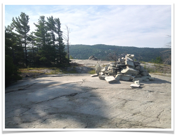
 Then you are up on the high ridge again following cairns and enjoying views of David Lake to your left, and Boundary Lake to your right.
 Looking back behind me to the right, I could see where I camped last night.
 And just ahead on the trail, I could see Silver Peak looming …

The trail dipped down to the right into the forest as I approached the Silver Peak junction, and I came upon a deer by the side of the trail (it is in my video) who seemed to not be too worried about me.
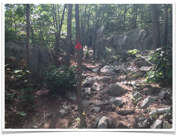
The junction is in the woods. The main trail makes a 90 degree turn to the left, while the Silver Peak Trail is marked with red blazes. Navigation should not be a problem !
 I stashed my backpack at the bottom, squirrels be dammed ! The trail up is fairly steep as I anticipated, but it took me less than 30 minutes to get up – half of what I expected.
 If it is a clear day at all, and you have the time, this really should be a must do. Near the very top, footing can be a bit awkward. Best to go slow and careful.
 Looking South, I could see where I would be heading the next couple days … and then all the way to Georgian Bay …

 Looking north west, I could trace most of the route I had already taken over the last few days.
 And looking north east, I could make out a couple of smokestacks from Sudbury … or at least I BELIEVED I could see them !
 This was also my first time seeing people in a couple of days. People will canoe in from David Lake to a spot nearby and make the trek up as a day trip. I took the opportunity to have them take a couple of pictures of myself having conquered the peak !
 I spent about an hour up there but could have spent more. It was at once exhilarating and peaceful. Sunscreen is a must ! And be ready for wind.
Returning down the peak and back onto the main trail (and picking up my backpack), the path was wide and open for the first kilometre. There is a right turn to the south for the main trail – don’t miss it or you are heading down to a canoe portage. I followed the trail as it climbed back out onto ridges … there are some amazing trees seeming to grow directly out of the rocks along the way.
 I reached the junction for Site 37 at 2:45pm – much earlier than I anticipated. And the trail to the site at Silver Lake is short, so I was there with plenty of time to set up and relax – which was nice !

 Again there was no tent pad – find a worn level spot …
 Access to the water was easy, but I had one small issue with this lake. I tried to swim, but it wasn’t quite deep enough as the bottom had silted up. For this reason alone, if there was only one thing I would change on this trip (and looking back, there really is only one thing) I would have continued on this day and camped at site 45 or 46 at Bunnyrabbit Lake – another 90 minutes.
 Having said that, the lake IS beautiful, another amazing setting for a campfire.
 It was off to bed early, and I hoped an early start the next day to Proulx Lake, but mother nature was about to break her perfect weather streak !
Day 6 – H37 to H48 (Proulx Lake) – Silver Peak Section
 Difficulty – 8.5 (9 because wet)
Views – 9
Time – 6.5 hours
Campsite – 9.5
Waking up to the sound of rain makes you want to just nuzzle down into your sleeping bag and wait it out until it stops. I did just that this morning – but by 9:00am, I realized it might not stop, and I had to get packed up and ready to go if I was going to make it to my next campsite tonight ! The goal was to get everything packed up that I could while in my tent, and put on the pack’s rain cover before setting it under a tree. Then, take down my tent and fly, shake them as free of water as I could, fold them up wet and put them in a plastic bag before stuffing them in my backpack. It was a slow process, and I wasn’t on the trail until 11:00am.
I was pretty pleased at how dry I kept everything – especially boots and socks. With my rain suit and pack cover on, I was good to go. And of course, once you are fully prepared and dressed for the rain, it stops ! I can’t complain … it is a tough slippery trail when it is raining. As it turned out, it was still a moody, cloudy afternoon for my hiking, and that is a very cool “mood” to see on this trail for at least one day.
 Jeff’s Killarney map showed me that the trail took me around the end of Silver Lake through some lush, damp forested areas … prime spots for some fun fungal growth !
 It is mostly a climb, but as is often the case on this trail, my uphill climbs were peppered with some tough downhills. With the path still wet from the rain, these required a lot of careful patience. The blue marker says it all – pretty much straight down.
 But once I reached higher elevations, I spent a lot more time on open quartzite. Looking northwest, the looming mountains were shrouded by the clouds while mist and fog blew down the valley. It seemed to make the mountains feel like they were closer to me.
 The trail gives beautiful open views of the small lakes that dot this area.
 Looking to the south, the skies over Georgian Bay were a clear blue. The pictures don’t do justice to the feel that the clouds gave this day. It was like they added to my depth perception – adding dimension and perspective.
 There are a lot of tough up and downs on this section. And whenever I thought I had it tough, I would come across a tree growing in the most unlikely spot … and I would think if this tree is tough enough to make it, then I can be too.
 I’m joking a bit, but to be honest, this was the most visceral feeling day of the hike for me. Not that the other days were too easy, but this day felt like a challenge that I had to step up to and meet. It felt good.
By late afternoon I reached the point on the trail where you overlook Proulx Lake, and you can actually see the little peninsula that juts out for campsite H48. I used a high tech technique to point it out.
 The trail drops down into the woods and you pass the southern tip of the lake on the main trail.
 I continued on a short way through the woods and reached the side trail for sites H48 and H49.
 I followed the side trail … I passed the cut off to H49 which veers to the left, and continued on straight. A lot of the research I had done had said THIS was the one site you really needed to try to include on your itinerary. I can add my voice to this chorus. This spot is amazing.
 The site is on a peninsula, and you camp and have your fire on the very tip. I set up my tent on the designated pad (the only site I used that had a designated spot) …
 And then as if it was scripted, the clouds parted and I was treated to a rainbow !
 Then it was time for a swim in the impossibly blue water …
 Then supper, firewood gathering, drying of any dampness … a near perfect end to a day that had been so unpromising to start. It was likely because of the challenge, of how different this day was from all the others … but I look back most fondly on this day.
Day 7 – H48 to George Lake Trailhead – Killarney Ridge Section
 Difficulty – 8 (The Crack is a 9.5)
Views – 8 (First half a 9)
Time – 6 hours
Campsite – N/A
This day broke cloudy and cool – hot oatmeal and hot coffee was welcomed ! Having never done a hike of this length before, I wasn’t sure how I’d feel at this point. I was excited about the finish, about a shower, a meal that didn’t require boiling water poured in it … but I was also a bit sad. I savoured this day, starting with packing up camp for the last time. I knew from Jeff’s Map that this was kind of like two separate hikes. The first part is walking along the ridges that have dominated the last three days, then it is a dip down through an ominously named feature – “The Crack”. This is followed by a literal “walk in the woods” back to the trailhead.
I left the campsite and returned to the main trail. I passed Little Superior Lake to my right and was soon walking along the amazing quartzite ridges.

 As I was approaching The Crack, I could literally see the rain moving towards me. This tree reminded me, you can persevere ! That’s Killarney Lake and O.S.A. Lake behind it. Beautiful.
 Sure enough, the rain started to come down, making the rocky surface quite slippery. I had been a little nervous about how difficult The Crack was going to be. Now I was mildly concerned.
 I got to the top of The Crack at noon, and reached the bottom a half hour later.
 It was all it was cracked up to be ! A narrow pathway down, filled with a jumble of rocks. There are the usual blue markers of the main trail, as well as red markers that are there for the day hikers. Both point straight up and down !
 And it often feels like it is straight down. I would see a blue marker 100 feet vertically ahead, with a tangle of wet boulders between me and it.
 Slow going for sure, but it never felt impossible. I never had to remove my pack and lower it. I will say that reaching the bottom was one happy moment !
After that, the trail levels along a quartzite plateau with some cairns, but then it is a dip into the woods for the last three hours of hiking. Due to the rain, I didn’t have my camera out for this section of the hike. The trail gets quite open, flat and easy for much of the way – this is a fairly high traffic path for day hikers.
As I got close to George Lake, I could hear voices from the trail campsites H53 and H54. The rain stopped and the clouds parted … sunshine !
 I was pretty emotional at this point and had to stop. I can’t really describe it – it hit me like a wave and lasted a minute or two. One of those reactions where you look around after and are glad there was nobody to see it. I have found this several times since … it is like you visited somebody you really missed, and now you were getting ready to leave them. “Alive” I guess ? Can’t find it at Walmart.
As I approached the trailhead at George Lake Campsite, I was confronted by a couple of steep granite outcrops to climb up and down. It was like the trail was giving me a final test … a reminder that the last week was damn hard, but damn worth it.
 I came out of the woods at the trailhead and there was my car ! I had a bit of scotch in my trunk, and gave myself and the trail a well deserved toast !
Notes:
1) This trail is hard on you physically – be in shape !
2) The trail can be done in less time, but I don’t see the point – its not a competition. I was so glad I had time to stop and truly enjoy the views whenever I was hit with awe (often). Hurrying around this trail so you can say you did it quickly is almost counter intuitive to why you would want to be back in these amazing places in the first place. But to each his own … some people need to “win” I guess.
3) Book early if you want to get the sites you want !
4) The trail is well marked, but you NEED to have good maps and a compass. There are portages and side trails that can confuse you.
5) Good boots – there are steep uphills, downhills, and boulder fields. You don’t want blisters back there, so good, sturdy, broken in boots are important.
6) Sunscreen and hat – you are in the open a lot over the 100km – don’t get burned.
7) Bug repellant. These are real northern mosquitoes – they come with forks and knives. Don’t like DEET ? Get ready to suffer.
8) Cell reception – I probably had reception once or twice a day at the tops of the ridges, but don’t count on it !
9) Toilet paper – you are on your own for this. There are “thunderboxes” at every site, that’s as luxurious as it gets.

Great description of the trail. Excellent photos; nice video too. Great shot of the deer! Were your hiking boots above the ankle, or lightweight hikers?
LikeLike
Lightweight hikers …
LikeLike
Thanks for writing such a detailed description.
LikeLike
I just wanted to thank you for taking the time to post your entire experience. I am preparing to do this hike in the summer ( as I’ve been talking myself into it for almost 3 years now ) and thanks to your post I won’t feel like I’m “going in blind”. I actually feel relaxed about it, prepared. You have included such great detail. I hope that you have had many great experiences since this hike but it sounds like this hike might be somewhat life-altering. Which is what I’m hoping for. Everyone has a point where they wonder who they are and this is my plan for taking some time to figure that out! Thank you for making the journey a little easier.
LikeLiked by 1 person